I was visiting work clients when my phone pinged with an alert: a vehicle crash in Alameda. It caught my attention due to its location: the neighborhood intersection my kids and I walk through every morning to school and that my kids and my wife drive back through each evening on the way home:
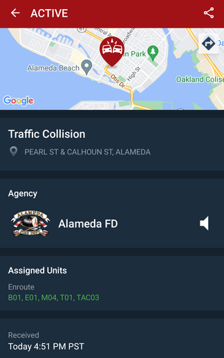
Fortunately I didn't see an email notification in my inbox about the kids haven been checked out of aftercare already, so they weren't yet near that intersection. (We can get notifications of so many different events these days — too many events? or not enough? Probably simultaneously too many and yet not enough...)
According to PulsePoint, Alameda Fire staff stayed at the intersection of Pearl and Calhoun for 36 minutes. In a week or two, I could file a PRA request with AFD to get a copy of their report that would indicate if at the end of that time on-site they transported anyone from the crash to a hospital — as an indirect measure of the crash's severity. But unfortunately state law makes all police reports for vehicular crashes confidential, so we'll only know whether there were severe injuries next year, when Planning Dept staff review the APD reports for crashes and tally all the severe crashes across the city.
On the way to school the next morning, I chatted with a Public Works staffer tasked with picking parts of broken car from the intersection. He didn't know about the crash itself — but he did guess that speed was involved. The fact that a fire hydrant was bent on its side (plus a street sign at an extreme angle) were visual clues of what had happened the evening before. He was using a snow shovel to pick up small and medium-sized pieces of plastic and glass from all four corners of the intersection:

Nah, probably just impatient to get home or to deliver a lukewarm overpriced burrito to an Uber Eats customer...
My spouse says her best guess based on passing the crash later while APD and AFD were on the scene was that one car had been headed northbound on Pearl St (which is controlled with a stop sign) and that car hit into another car that was going eastbound on Calhoun and turning left to go north onto Pearl. So both vehicles ended up facing northbound on Pearl...
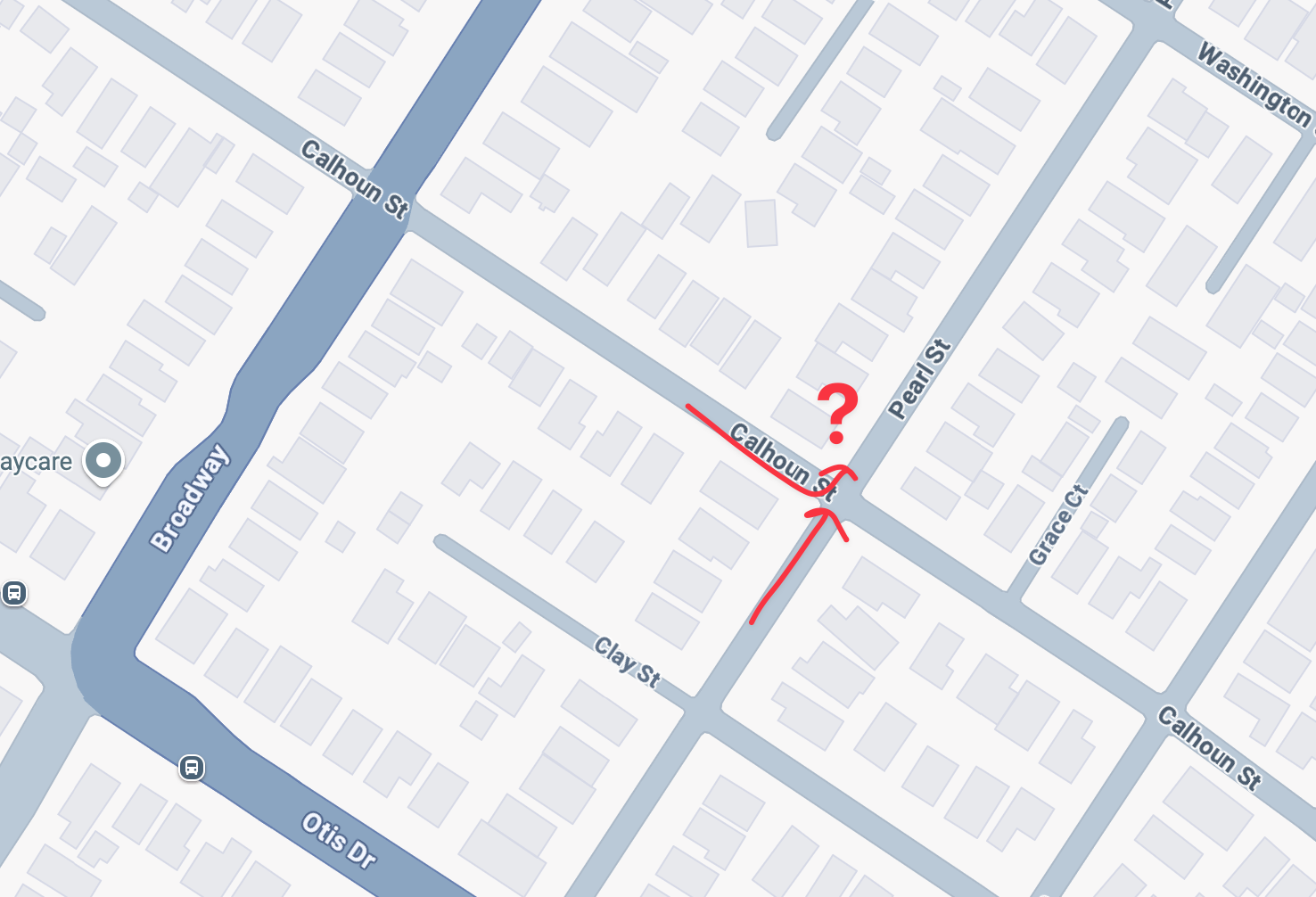
Whatever the configuration of the vehicles, it's reasonable to assume that excessive speed was involved and that at least one vehicle entered the intersection without fully obeying a stop sign.
Note that this crash took place at 4:50 p.m. There may have been a bit of rain, but it was daylight. It was also a time when many kids and families are walking home from school or to other activities. This is a particularly bad time for a crash (not that there is ever a "good" time for car crashes)
What could be done to improve this situation and decrease the odds of more crashes here?
Zooming into this intersection
Zoom into the intersection of Pearl St and Calhoun St — and this will remind regular readings of this week's blog post about mini roundabouts. This intersection has a lot of empty pavement — too much empty pavement — at its center:
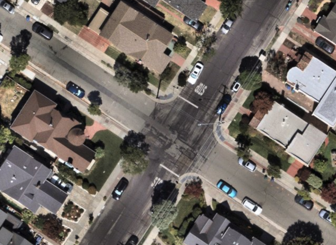
A mini roundabout could be an ideal safety improvement to this intersection. Its "horizontal deflection" would force through-traffic to slow down. And it would force drivers to take turns when entering the intersection.
Zooming out from this intersection
But it's also worth zooming out and considering this intersection in its overall context. A street network is an interconnected network, after all:
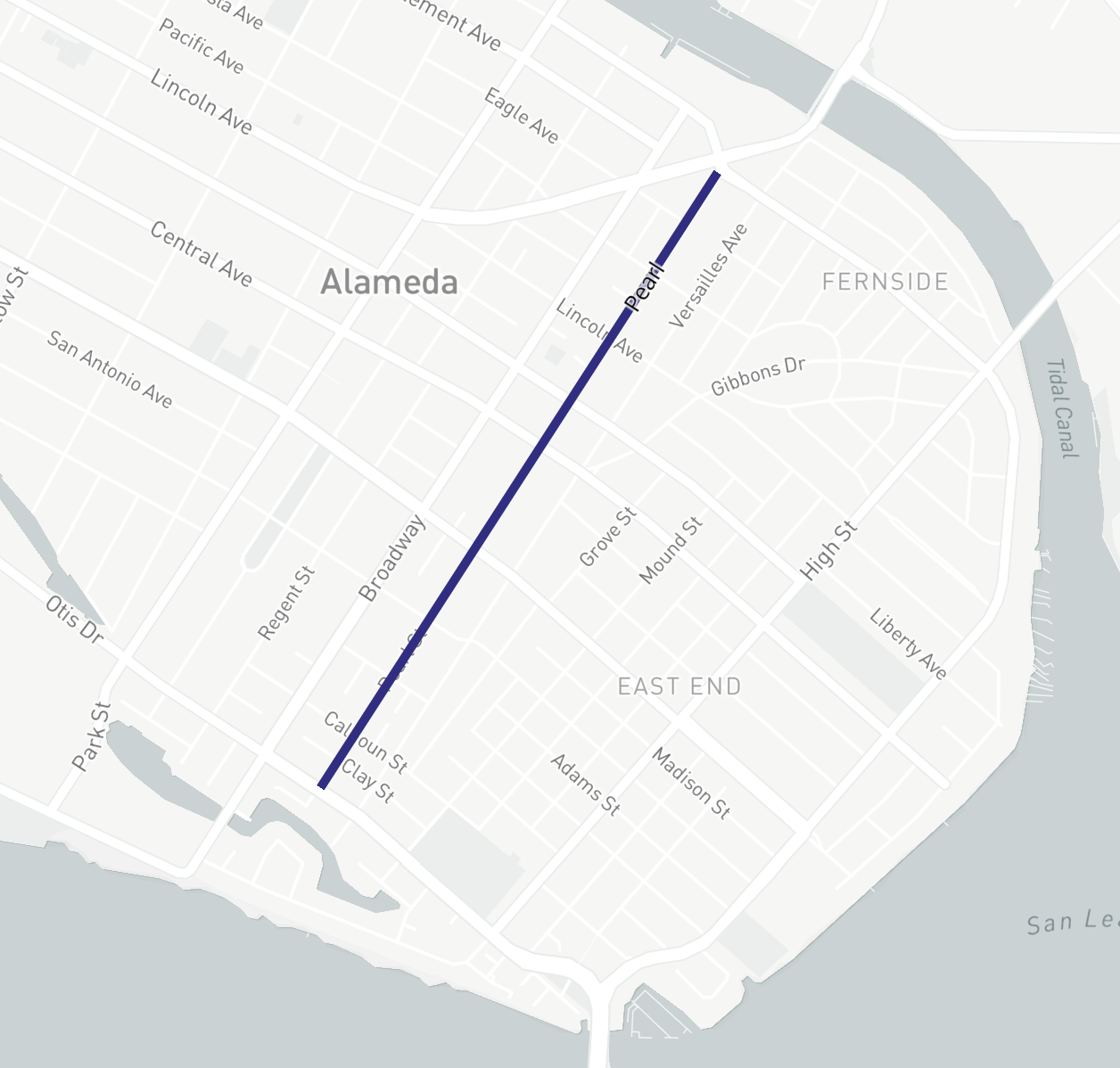
Pearl Street is a north(ish)/south(ish) street that parallels the larger Broadway for its entire length.
This makes it useful to people traveling along the same "corridor" as Broadway. I often walk along Pearl when I don't want to walk alongside the cars and trucks on Broadway with my kids. And some people choose to drive along Pearl because they think it might be faster than driving on Broadway — plus, often at busy times of the day, Google offers them the option (in light blue):
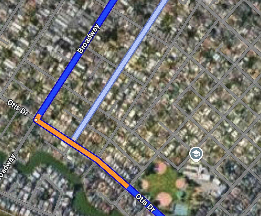
The reason Pearl is appealing to these drivers is because it appears on maps as a straight shot all the way down to Tilden and the Fruitvale Bridge.
However along the way are many smaller intersections like this one at Calhoun/Pearl, as well as many unprotected crossings of larger streets. If you've observed drivers cutting dangerously across Encinal at Pearl, or Central at Pearl, it's for the same reason — because they're trying to get that lukewarm burrito from Chipotle to their Doordash customer (or they're just an impatient) and Pearl St pops up on their screen as the quickest route.
The fix at the end
The city does have a longer term strategy that could improve this overall situation.
The "modern roundabout" at Clement Avenue/Tilden Way will partially close the outlet at the northern end of Pearl St. Drivers will only be able to go from Pearl to eastbound Fernside (not cut across the lanes to continue on to northbound Tilden):
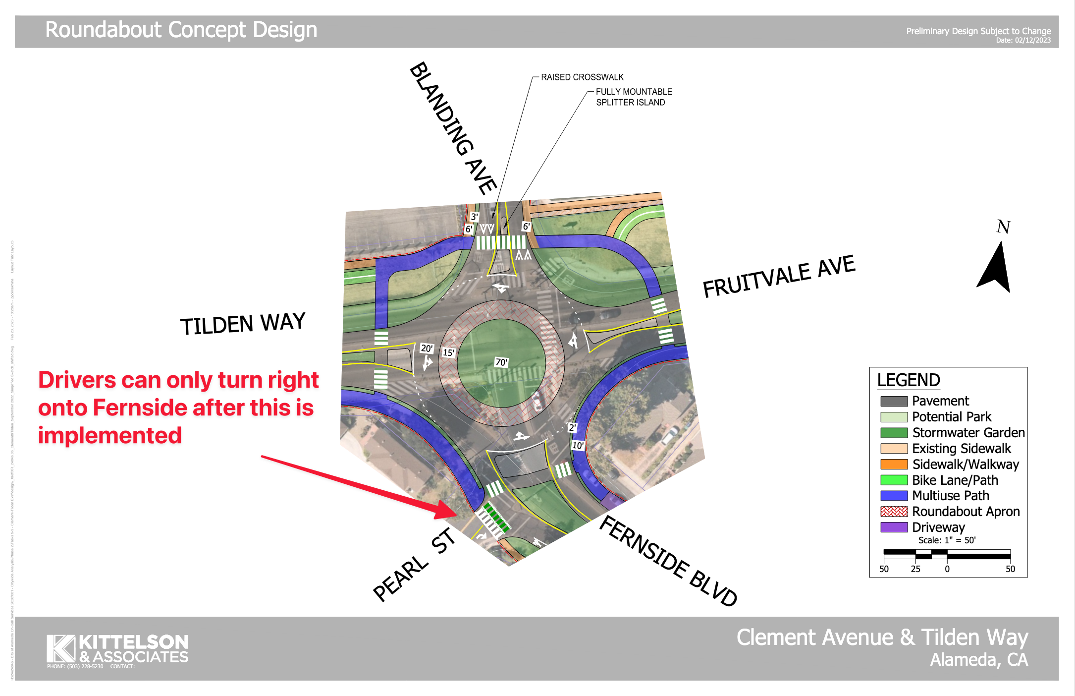
The planners' reasoning for limiting the Pearl/Fernside intersection are twofold:
- to make it fit into the newer arrangement of the roundabout
- and to reduce the odds of collisions right at the current weird little intersection:
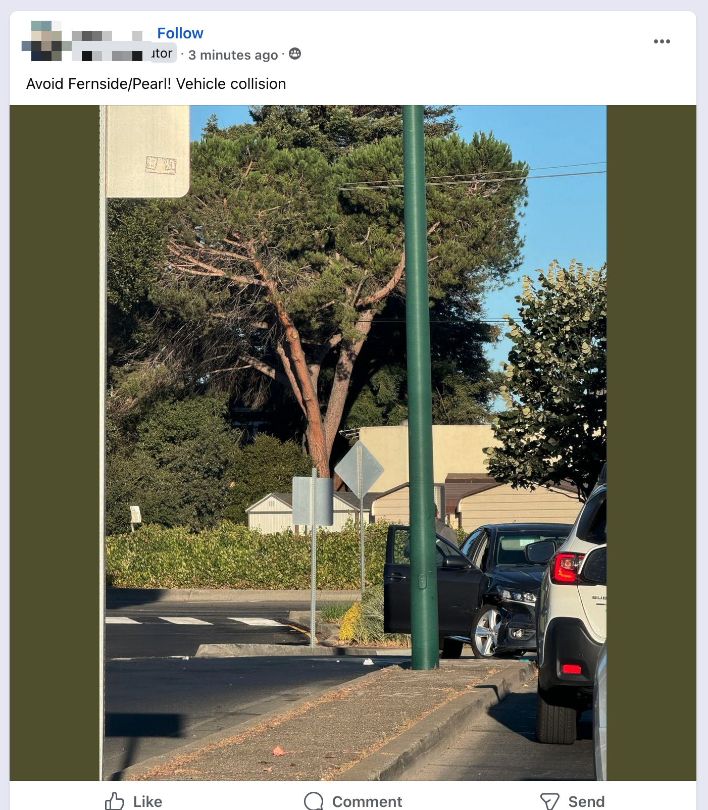
When you zoom out and think about the eastern half of Alameda Island as an entire transportation network, a third advantage of partially closing Pearl/Fernside comes into view:
- slightly but systematically decreasing the odds of drivers driving over the speed limit along the entire northbound length of Pearl Street — through the intersection at Calhoun/Pearl and all the other uncontrolled or partially-uncontrolled intersections along the way
This change is only to constrain the options at the very end at Pearl/Fernside — not to to change the ability of drivers to make full use of Pearl all other blocks along the way.
Given that the plans are already set for Tilden, why not move ahead now? Do city staff have a few more of those dark green concrete traffic barriers? Simply place a few at the very northern end of Pearl St along with appropriate signage one and/or two blocks in advance.
Right after the barricades are in place, I'll be glad to add the turn restriction to appropriate node in OpenStreetMap. And one of ~5,000 India-based contractors can make a similar edit in Google Maps. Then we'll have every slightly shifted the behavior of a decent number of drivers across Alameda — and slightly but meaningfully reduced the odds of them speeding and crashing into other cars, street signs, and fire hydrants along the way.
City staff just released a new rendering of a potential mini roundabout and they continue to solicit input about the overall Neighborhood Greenways program. There's a survey you can complete before Dec. 20.