Here's a video that a Morning Bun reader shared. It's of a speeding driver, earlier this week, hitting a post on the sidewalk at 5th St and Stargell Ave (near the Safeway) and just keepin' on speeding ahead.
For full effect, turn on the audio. That's the sound of the driver destroying a metal post holding the "beg button" for pedestrians:
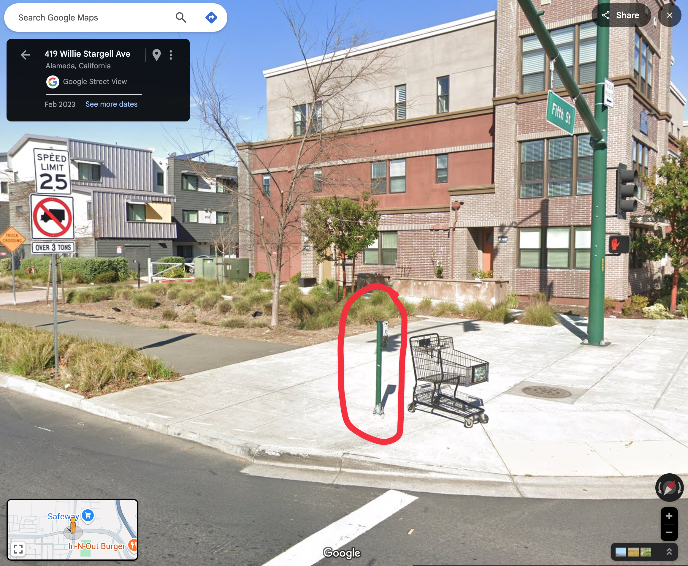
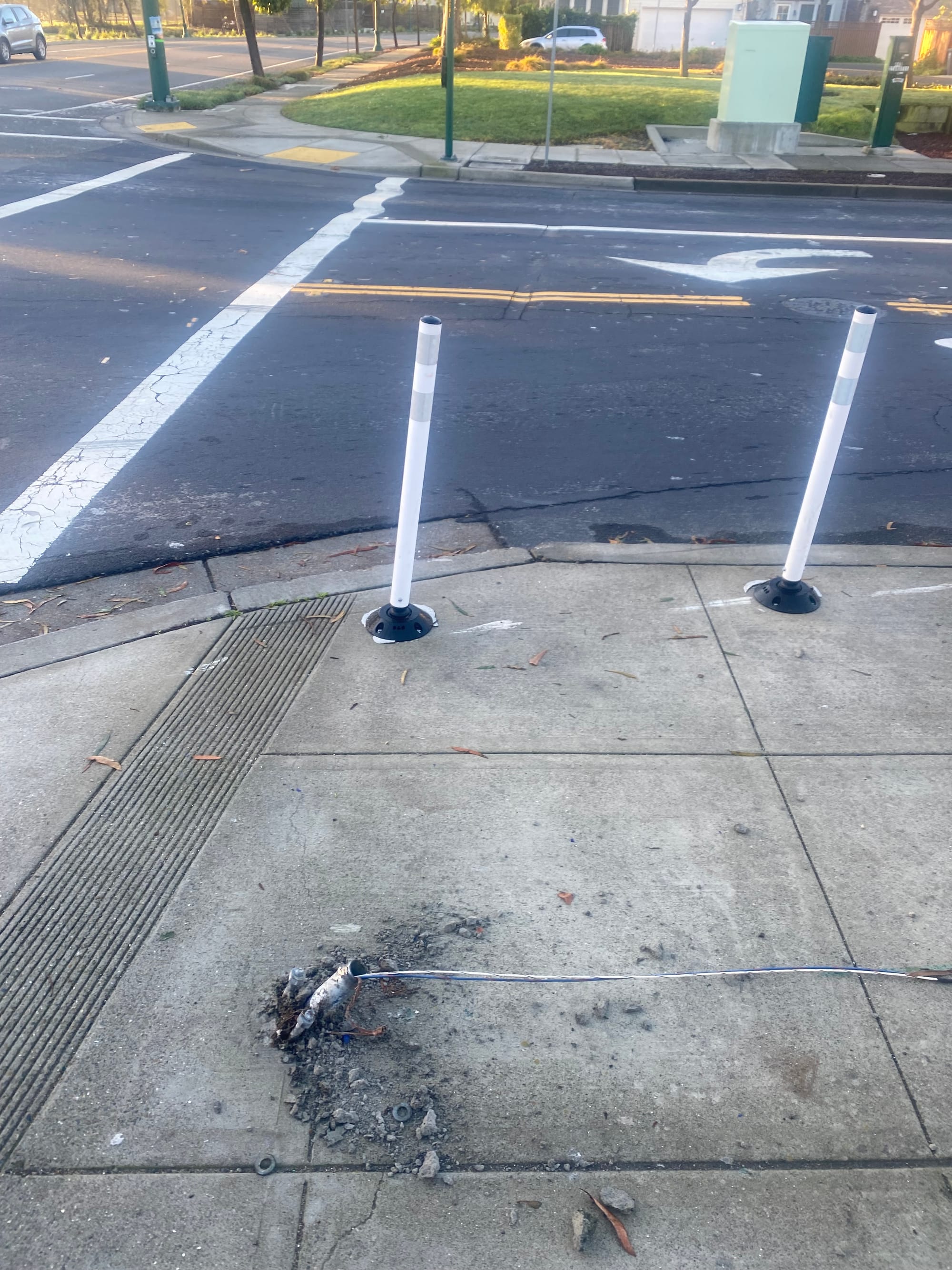
Left: before in Google Street View from 2023 Right: after the car crash in February 2025
Per the professional practices of American traffic engineering, this infrastructure performed as intended!
That post crumbled, allowing the speeding driver to continue on their way. And if that speed limit sign and no-truck sign were also hit, that sign post also likely broke away as intended.
If a Martian were to land on this planet and start walking around as a pedestrian, they might think that these road-side features are designed to provide some marginal added physical protection for pedestrians standing near roadways. But they'd be wrong.
Because this is the clear zone.
Clear zones and break-away posts
Clear zones are most visible on rural highways. It's the open space alongside the pavement edge. It's so as the Red Bull leaves your system on a late-night drive and you let your car drift, you drive off into grass and can either regain control of your vehicle or stop safely.
Clear zones are very intentionally the opposite of idyllic rural French roads lined by rows of trees — because if inattentive drivers crash into those trees, the trees might "win."
In the clear zone alongside a highway, traffic engineers insist that all fixed impediments be designed so that they'll easily break away if hit by a driver, or that they're surrounded by shielding barriers.
That does make sense for real highways.
But here's the part that might make no sense to the Martian on foot: Even for streets in built-up areas, traffic engineers insist on fixed objects being located as far away from the roadway as possible:
FHWA policy is that utility facilities should be located as close to the right-of-way line as feasible. The Green Book, AASHTO Highway Safety Design and Operations Guide, 1997, (Yellow Book) and the AASHTO A Guide for Accommodating Utilities within Highway Right-of-way, all state that utilities should be located as close to the right-of-way line as feasible. The Yellow Book, recognizing that crashes are overrepresented on urban arterials and collectors, says this means as far as practical behind the face of outer curbs and where feasible, behind the sidewalks.
Sometime within the last week, FHWA fully removed the subset of its website dedicated to "complete streets." Perhaps FHWA will replace the pages with guidance on how to increase your community's rates of hetero-normative marriage and baby-making?
(More seriously, here's a new analysis from the Urban Institute of the likely subpar impacts of this strange new criteria for evaluating competitive applications for federal transportation grants.)
But back to the point at hand: The goal of traffic engineers is to reduce any and all fixed objects that a driver might hit next to a roadway. Even if sidewalks may look like they're the pedestrian realm, they aren't — rather, sidewalks are designed to be extra emergency space for drivers:
- That's, more or less, why a drivers can hit a metal post at Stargell/5th and keep on going, without even stopping to check their car for damage.
- This is also what will happen if a driver someday hits the gigantic traffic signal posts and masts recently installed by Caltrans along the State Route 61 portions of Broadway and Encinal Ave. The post will sheer off at its breakaway bolts. The entire post and attached mast arm may then fall onto a nearby house (or pedestrian or dog or wild turkey) but what's key is that the professional priorities of the "Green Book" will have been honored: the driver in the vehicle will be saved from the impact of hitting a fixed obstacle.
It's a sad but easy bet that the new Secretary of Transportation is already banning references throughout USDOT HQ to the The Negro Motorist Green Book.
- This is also why the city doesn't quite know what to do about Ralph Appezzato Memorial Parkway, where a speeding driver killed a pedestrian on the sidewalk in 2020 and last month another driver killed a pedestrian in a wide crosswalk at the same exact intersection. While those crashes involved different specific failures, both were likely exacerbated by the fact that the straight-away stretch of multi-lane roadway, with wide auto travel lanes, is edged with no more than paint and concrete curb of ~6" in height.
- And this is also why the city's recent safety improvements at Lincoln/Walnut mainly use paint, plastic posts, and flashing lights (set back from the roadway and presumably mounted using break-away bolts) to visually advise motorists to please not kill another pedestrian at that intersection (as happened in 2021) and to please not crash into a bedroom (as happened in 2019).
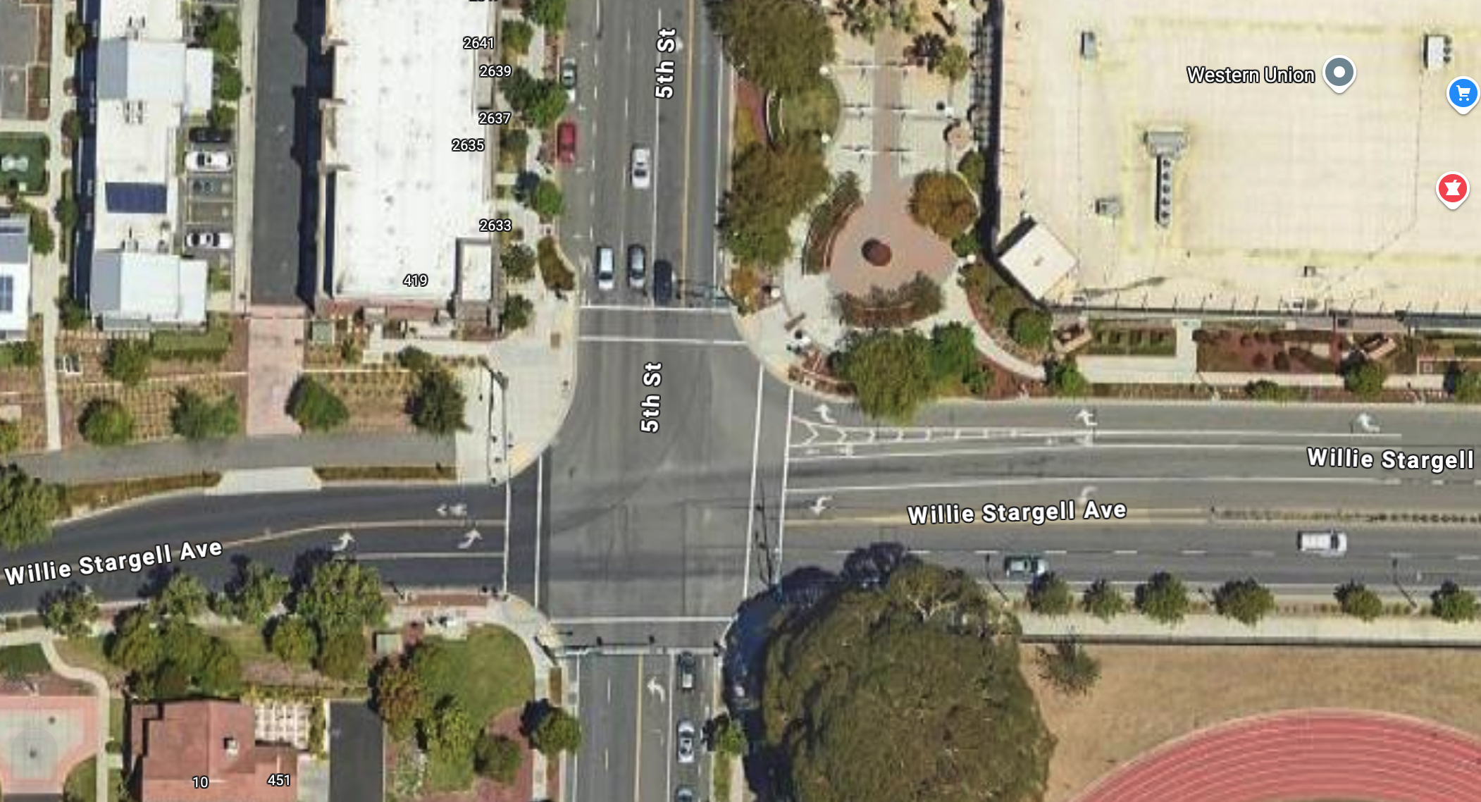
A roundabout for 5th and Stargell
While Alameda's engineers and planners may not be able to fully break away from the dictates of American traffic engineering practices, they are getting creative with an increasing range of street and intersection designs becoming available to forward-thinking cities.
Whereas AASHTO is led by the engineers of state highway departments, NACTO is led by engineers and planners of city transportation departments and transit agencies — that is, organizations that are aware that human beings also exist outside of the cocoons of automobiles.
Here's an occasional reminder that it wouldn't cost the City of Alameda that much per year to join NACTO as an affiliate member.
This week, Alameda staff just released new proposed plans that involve turning the oversized intersection at Stargell/5th into a modern roundabout:
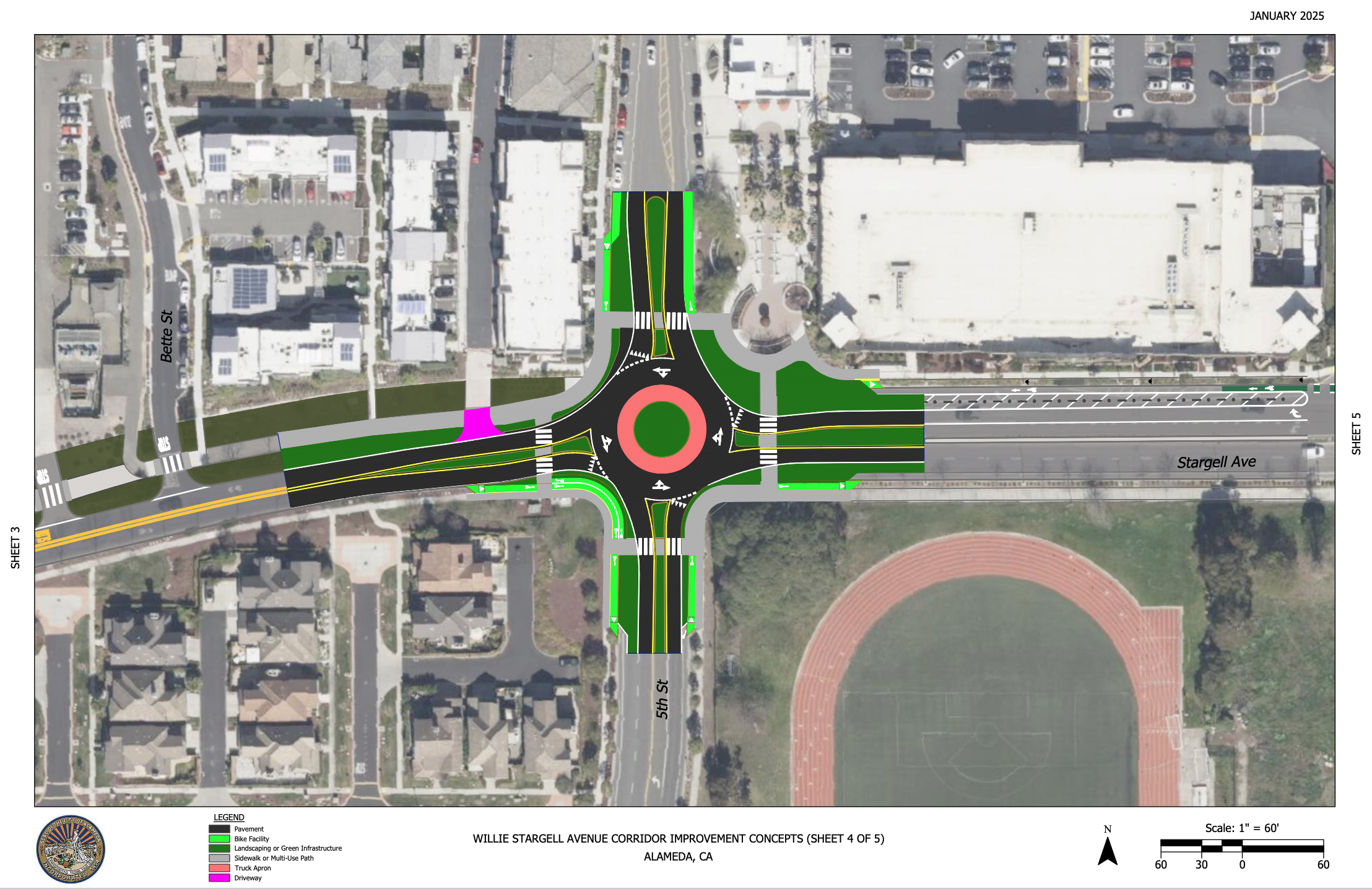
(Another modern roundabout is also in the plans for the intersection to the east.)
If implemented, these plans will resolve a problem introduced at Stargell/5th back in 2008.
My incomplete understanding as a relative newcomer to Alameda is that that is when the Fleet Industrial Supply Center was being redeveloped into the Target/Safeway shopping center, and also when one of the many iterations of unrealized plans for Alameda Point was underway. Stargell Ave was built with 4 thru-lanes for autos next to the shopping center, with the goal of moving lots of drivers to and from their new homes (all single family?) further west at Alameda Point. But that wasn't realized and instead the oversized portion of Stargell Ave suddenly steps down to just 2 thru-lanes of auto traffic at this specific intersection.
So, the driver hitting the post this week was just trying to travel the "desire line" envisioned by previous Alameda Point plans!
Modern roundabouts aren't the solution for every intersection around Alameda. They are fine but not great for cyclists. And they are not relevant to the many different challenges of autos speeding along straight-aways, failing to yield to pedestrians and cyclists, or double-parking in unprotected bike lanes. Still, keeping these limitations in mind, a one-lane modern roundabout at Stargell/5th would at least finally stop these crazy drivers from taking traffic engineers up on the open invitation to dangerously crash through the clear zone.